Nelson City Council releases coastal inundation map viewer for feedback
18/11/2020 2:24am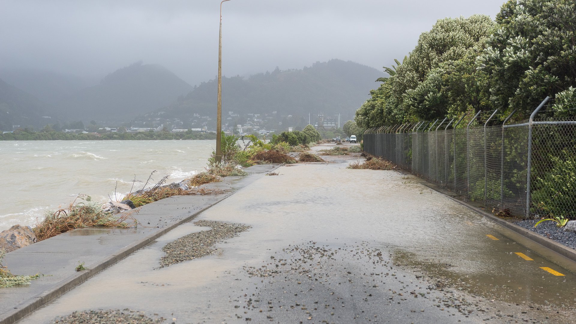
The science is clear that our climate is changing and will continue to do so in the future. For example, we are already seeing the impacts of more extreme weather events in Nelson. Part of Nelson City Council’s role is to understand what the impact will be for our region and to work with our community.
The New Zealand Coastal Policy Statement 2010 requires Nelson City Council to identify areas that are potentially affected by coastal hazards giving priority to identifying areas at high risk of being affected, and to assess hazard risks over at least 100 years. We already account for sea level rise in new developments and now we want to better prepare our communities for the long term impacts of climate change, including ongoing changes to weather patterns and rising sea levels. This conversation is not new for many, nor is it unique to Nelson. It is occurring in coastal communities all around New Zealand as well as globally.
We are making available on our website a coastal inundation map viewer that uses a ‘bathtub model’ to show the potential effects of future sea level rise and coastal inundation, the flooding of low-lying coastal land with seawater, on Nelson’s coast. The map viewer shows land that is vulnerable to the impacts of sea level rise from present day up to a 2 metre sea level rise scenario – a scenario predicted to be beyond the year 2150. Residents will be able to search for their own property to view the different scenarios.
All owners of properties within the potentially impacted area, which is approximately 4500 properties, will receive a letter letting them know that as we now hold this information we are required to include the information on Land Information Memorandums (LIMs).
Mayor Rachel Reese says that people should view the maps as a starting point for finding out more about how their own property, or places they value like beaches and estuaries, could be affected at different sea levels.
“We really want people to come and talk with us and let us know what places they value along the coastline, and their experiences with coastal inundation. Our maps are based on the best information we have at the moment, but we value any further information or discussion based on people’s own experience and knowledge.”
“The uncertainty of climate change and sea level rise means that we can only project what we know could happen, not what will happen.”
The map viewer shows how coastal flooding will change for a range of sea level rise scenarios (0.5, 1.0, 1.5 and 2.0m). Predicting the amount of future sea level rise is a complex issue, and a component of this is the amount of greenhouse gas emissions we continue to emit, now and in the future. The Ministry for the Environment recommends assessing a range of future scenarios for the assessment of coastal inundation. These are called ‘Representative Concentration Pathways (RCPs)’ and range from a low emissions scenario to a very high emissions scenario. The RCP table which provides projected levels and dates of sea level rise can be viewed at shape.nelson.govt.nz, via the map viewer.
The release of the maps follows engagement in 2019 when Council opened a discussion with the community on coastal hazards through a series of public drop-in sessions, a hui at Whakatū Marae, a feedback survey, an online hub and one-on-one meetings. Feedback from the community was that people wanted more information about coastal hazards and the potential impact on their properties.
The maps and process for engagement are closely related to the work Tasman District Council started in 2019 and will help us build on existing shared approaches to hazard management. Further coastal erosion and modelling work will be completed in early 2021.
Community input from 18 November to 18 December
The maps will be available online at shape.nelson.govt.nz from 18 November, along with an online form you can use to provide input. We need to hear about the things that are important to you that may be impacted by rising sea levels. These may be areas, objects or experiences that you value - whether your own assets, beach access, community facilities, heritage items or coastal habitats for shorebirds and other native species. We’ll also be asking you to share your observations of coastal hazards in our city – building on the information we received in 2019.
There are many ways to get involved:
Go to shape.nelson.govt.nz to view the maps, answer our short survey, share your observations of coastal hazards and provide any comments on the coastal inundation map viewer.
View the maps and pick up a survey form from Civic House, 110 Trafalgar Street or at the Elma Turner Library.
We welcome your feedback until 17 December 2020. Further engagement is planned for 2021 on this issue.
Nelson City Council is holding community drop-in sessions, allowing the public to look at the coastal inundation maps and ask questions. A leading NZ coastal scientist, Mr Jim Dahm, will be attending these sessions to answer questions, alongside Council staff with local knowledge and expertise. These are informal sessions so the public can drop in any time between the times below:
Tuesday 24 November, 4.30-7.30pm at Greenmeadows Centre, corner of Main Road, Stoke and Songer Street, Stoke
Thursday 26 November, 4-6.30pm at Trafalgar Park Pavilion, 30 Trafalgar Street, The Wood
This is an opportunity to build on the conversation we started last year, to talk about the effect of sea-level rise and coastal hazards including inundation across the Nelson coastline, however, it won’t be the last. How our communities adapt and respond to climate change issues will be the subject of an ongoing programme of work.
End
Contact: media@ncc.govt.nz


